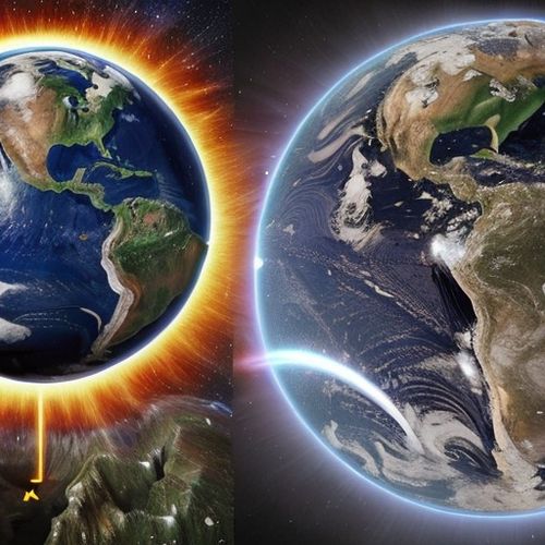
The Earth's mantle remains one of the last great frontiers of geological exploration, with mantle plumes representing some of the most enigmatic features beneath our feet. Recent advances in seismic tomography and computational modeling have revolutionized our ability to visualize these towering thermal upwellings in three dimensions, offering unprecedented insights into their structure, dynamics, and relationship with surface volcanism.
For decades, the very existence of mantle plumes was hotly debated within the geophysical community. The classical plume hypothesis proposed by W. Jason Morgan in 1971 suggested that narrow, stationary columns of hot material rise from the core-mantle boundary to feed hotspot volcanoes like Hawaii and Iceland. However, without direct observational evidence, alternative explanations gained traction. The development of high-resolution 3D imaging techniques has fundamentally transformed this debate by providing tangible visual evidence of these deep Earth structures.
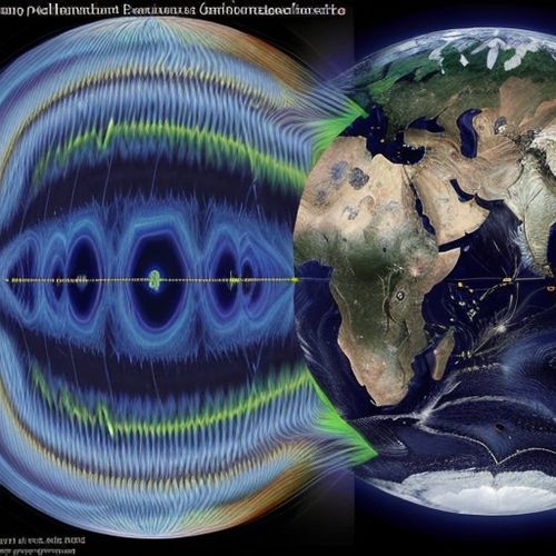
Modern seismic tomography has emerged as the primary tool for illuminating mantle plumes in three dimensions. By analyzing the travel times of seismic waves from thousands of earthquakes recorded at stations worldwide, researchers can reconstruct velocity anomalies that reveal variations in temperature and composition. The latest generation of whole-mantle tomography models achieves spatial resolutions approaching 100 km, allowing scientists to trace plume conduits through much of the Earth's interior. These images consistently show narrow, low-velocity columns extending from known hotspot locations down to at least the mantle transition zone, with some appearing to originate from much greater depths.
The transition from 2D to 3D imaging has been particularly transformative. Early tomographic models could only provide slice-like views of the mantle, leaving the full geometry of plumes ambiguous. Contemporary approaches now render plumes as continuous 3D structures, revealing their true morphology - often tilted, bent, or branching in response to mantle flow patterns. This dimensional leap has exposed the complex interplay between plumes and plate motions, mantle convection, and chemical heterogeneities.
Computational advancements have been equally crucial to this imaging revolution. The inverse problems involved in seismic tomography require solving systems with billions of parameters, pushing the limits of supercomputing. Novel algorithms like adjoint tomography iteratively refine models by comparing synthetic and observed waveforms, while machine learning techniques help extract subtle signals from noisy data. These computational tools now allow researchers to detect plume structures that would have been invisible just a decade ago.
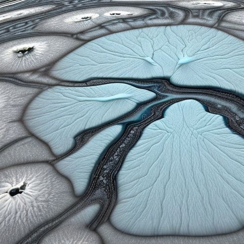
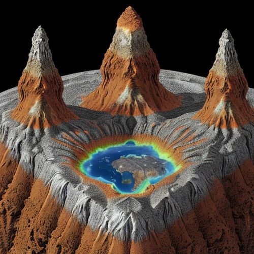
Perhaps the most striking revelation from 3D imaging is the diversity of plume structures. The Hawaiian plume appears as a relatively straight column descending to at least 1000 km depth, while the Iceland plume shows a more complex geometry with possible roots near the core-mantle boundary. Beneath Africa, the "African Superplume" manifests as a massive, sheet-like upwelling unlike any other structure. This variability suggests that plumes may form through different mechanisms and originate from various depths within the mantle.
The connection between deep mantle structures and surface volcanism has become clearer through these imaging efforts. Many hotspots now show seismic continuations to great depths, supporting the plume hypothesis. However, the relationship isn't always straightforward - some presumed hotspots lack obvious deep roots, while certain deep upwellings don't correlate with surface volcanism. This has led to refined models where plume strength, mantle composition, and lithospheric thickness all influence whether a deep upwelling produces detectable surface expression.
Beyond seismic methods, multidisciplinary approaches are enriching our 3D perspective. Geodynamic modeling constrained by tomographic results can simulate plume dynamics over geological timescales. Mineral physics experiments provide crucial data on how temperature and composition affect seismic velocities. Geochemical analyses of hotspot lavas offer independent constraints on plume sources. Together, these techniques form a powerful toolkit for probing plume nature and evolution.
One of the most significant findings from 3D imaging concerns plume origins. While some plumes appear to rise from the core-mantle boundary as classically envisioned, others may originate from intermediate depths or thermal boundary layers within the mantle. This has important implications for understanding Earth's heat budget and chemical cycling. The detection of possible plume clusters near the edges of large low-shear-velocity provinces (LLSVPs) at the base of the mantle suggests these dense, chemically distinct regions may play a key role in plume generation.
The improved resolution has also revealed fine-scale structures within plumes. Many show evidence of secondary instabilities, thin trailing conduits, or surrounding halo regions of partially molten material. These features provide clues about plume rheology, melt generation, and interaction with the surrounding mantle. In some cases, plumes appear to be sheared or disrupted by mantle flow, explaining why their surface hotspots can appear to wander over time.
Looking ahead, several promising directions are emerging in mantle plume imaging. Next-generation seismic networks, including ocean-bottom seismometers and dense continental arrays, will provide higher-quality data for tomography. Advances in full-waveform inversion promise to extract more information from each seismic signal. Incorporating constraints from gravity, geoid, and electromagnetic data will lead to more comprehensive 3D models. Perhaps most exciting is the potential to image plumes in time as well as space, tracking their evolution through high-resolution four-dimensional tomography.
As imaging techniques continue to improve, we may finally resolve long-standing questions about mantle plumes: Are they primarily thermal or chemical in nature? How do they interact with plate tectonics over Earth's history? What role do they play in mantle convection and heat transport? The three-dimensional perspective has already transformed our understanding of these fundamental Earth processes, and future advances will undoubtedly reveal even deeper insights into our planet's inner workings.
The story of mantle plume imaging exemplifies how technological innovation can revolutionize geoscience. From speculative concepts on paper to vividly rendered 3D structures, our view of plumes has undergone a remarkable transformation. As computational power grows and observational networks expand, we stand at the threshold of even more detailed explorations of Earth's deep interior - explorations that will continue to reshape our understanding of the dynamic planet we call home.

By Ryan Martin/Apr 19, 2025
By Samuel Cooper/Apr 19, 2025
By Elizabeth Taylor/Apr 19, 2025
By Olivia Reed/Apr 19, 2025
By Benjamin Evans/Apr 19, 2025
By Grace Cox/Apr 19, 2025

By Megan Clark/Apr 19, 2025

By Megan Clark/Apr 19, 2025

By Christopher Harris/Apr 19, 2025
By Elizabeth Taylor/Apr 19, 2025
By Olivia Reed/Apr 19, 2025
By Grace Cox/Apr 19, 2025

By Benjamin Evans/Apr 19, 2025

By Lily Simpson/Apr 19, 2025
By Grace Cox/Apr 19, 2025
By Sarah Davis/Apr 19, 2025
By John Smith/Apr 19, 2025

By Grace Cox/Apr 19, 2025

By Victoria Gonzalez/Apr 19, 2025
By Elizabeth Taylor/Apr 19, 2025